UN
8 Hazelwood Road
£ 205,000
Description
We don't have a Description for this property.
- Bedrooms
- 3
- Bathrooms
- 0
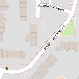

Leaflet © OpenStreetMap contributors
The heatmap indicates the level of crime in the area. The color of the heatmap indicates the crime severity and recency.
Metrics Year-on-Year
- Average area value
- 374,740.00 £Increased by 5.83 %
- Average area rental value
- 1,367.00 £/moDecreased by 6.24 %
- Est rental Yield
- 4.38 %Decreased by 11.34 %
- Crime Rate
- 5.00 %Unchanged by 0.00 %
from 354,111.00 £
from 1,458.00 £/mo
from 4.94 %
from 5.00 %
Nearby Schools
| Name | Type | Ofsted | Distance |
|---|---|---|---|
| St John'S Primary School | Academy Sponsor Led | Requires improvement | 0.30 KM |
| St John'S Primary School And Sure Start Children'S Centre | Children's Centre | 0.30 KM | |
| St Hugh Of Lincoln Catholic Primary School | Academy Converter | Good | 0.34 KM |
| The Oaktree School | Academy Converter | 0.52 KM | |
| The Hermitage School | Academy Converter | Good | 0.60 KM |
Images
Nearby Streets
| Name | Average Price | Average Sqft | Distance |
|---|---|---|---|
| Oakway | £ 475,000 | 0 | 0.00 KM |
| Elmgrove Close | £ 425,000 | 0 | 0.00 KM |
| Oakwood Road | £ 0 | 0 | 0.00 KM |
| Barton Close | £ 0 | 0 | 0.00 KM |
| Saint John's Lye | £ 0 | 0 | 0.00 KM |
Nearby Transport
| Name | NLC | TLC | Distance |
|---|---|---|---|
| Brookwood | 5687 | BKO | 3.15 KM |
| Worplesdon | 5686 | WPL | 4.08 KM |
| Woking | 5685 | WOK | 5.81 KM |
| Longcross | 5674 | LNG | 8.07 KM |
| Sunningdale | 5671 | SNG | 9.04 KM |
Nearby Listings
| Address | Price | Type | Score | Distance |
|---|---|---|---|---|
| Southwood Avenue, Knaphill | £ 469,000 | BUY | 6 / 10 | 0.11 KM |
| Victoria Road, Knaphill, Woking, Surrey, GU21 | £ 425,000 | BUY | 6 / 10 | 0.13 KM |
| Greenvale Road, Knaphill, Woking, Surrey, GU21 | £ 550,000 | BUY | Unknown | 0.14 KM |
| Greenvale Road, Knaphill, Woking, Surrey, GU21 | £ 550,000 | BUY | 7 / 10 | 0.14 KM |
| Inkerman Road, Knaphill, Woking, Surrey, GU21 | £ 485,000 | BUY | 6 / 10 | 0.16 KM |
Nearby Properties
| Address | Price | Distance |
|---|---|---|
| 9 Hazelwood Road | £ 300,000 | 0.00 KM |
| 1 Hazelwood Road | £ 345,000 | 0.00 KM |
| 14 Hazelwood Road | £ 355,000 | 0.00 KM |
| 8 Hazelwood Road | £ 205,000 | 0.00 KM |
| 11 Hazelwood Road | £ 210,500 | 0.00 KM |